- Posts: 46
- Thank you received: 14
Local Foothills Weather Forecasts
- Chief Meteorologist
-
 Topic Author
- Happy Camper
-

Less
More
23 Aug 2015 13:13 #51
by Chief Meteorologist
Replied by Chief Meteorologist on topic Local Foothills Weather Forecasts
No doubt about it. Unfortunately there isn't much change expected in the weather pattern until at least Wednesday. Some meteorologists (myself included) are pointing to high sea surface temperatures in the Gulf Of Alaska for the persistent high pressure that is affecting the Pacific Northwest.
Please Log in or Create an account to join the conversation.
- Mountain-News-Events
-

- Mountain Legend
-

23 Aug 2015 13:46 #52
by Mountain-News-Events
My Mountain Town Community Calendar - filter events by Category, date, or keyword to easily find events of interest. Add your community, church, or non-profit event to the calendar yourself! Click here to access the submission form. Businesses: please contact us for more information on adding your events! Questions? Email
Community News, Events, and Calendar Forum - Check here for the latest happenings in our community and add your own!
Replied by Mountain-News-Events on topic Local Foothills Weather Forecasts
@NASA
More than 100 fires burn in Washington state & no imminent relief is expected: go.nasa.gov/1U0eUVp #EarthRightNow
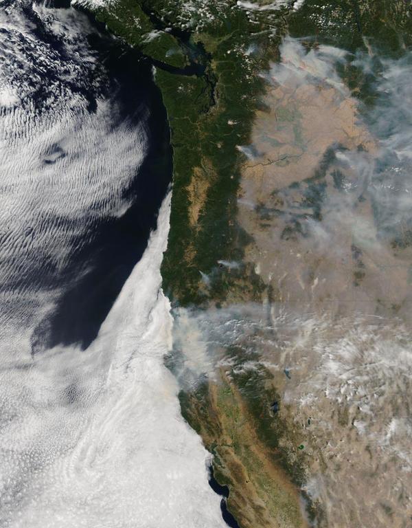
More than 100 fires burn in Washington state & no imminent relief is expected: go.nasa.gov/1U0eUVp #EarthRightNow
My Mountain Town Community Calendar - filter events by Category, date, or keyword to easily find events of interest. Add your community, church, or non-profit event to the calendar yourself! Click here to access the submission form. Businesses: please contact us for more information on adding your events! Questions? Email
Community News, Events, and Calendar Forum - Check here for the latest happenings in our community and add your own!
The following user(s) said Thank You: Chief Meteorologist
Please Log in or Create an account to join the conversation.
- NeutralGuy
-

- Mountain Folk
-

Less
More
- Posts: 115
- Thank you received: 7
27 Aug 2015 09:28 #53
by NeutralGuy
Replied by NeutralGuy on topic Local Foothills Weather Forecasts
Hope we get some of the rain I know it is only a 30% chance but things are starting to get brown around here.
I look forward to the cooler day too.
I look forward to the cooler day too.
Please Log in or Create an account to join the conversation.
- ScienceChic
-

- Mountain Champion
-

Less
More
- Posts: 15752
- Thank you received: 320
15 Sep 2015 10:39 #54
by ScienceChic
"Now, more than ever, the illusions of division threaten our very existence. We all know the truth: more connects us than separates us. But in times of crisis the wise build bridges, while the foolish build barriers. We must find a way to look after one another as if we were one single tribe.” -King T'Challa, Black Panther
The truth is incontrovertible. Malice may attack it. ignorance may deride it, but in the end, there it is. ~Winston Churchill
Replied by ScienceChic on topic Local Foothills Weather Forecasts
I know this'll make otis happy! 
Odds Increasing For A Very Snowy Winter In Colorado
September 10, 2015
By Justin McHeffey, CBS4 Meteorologist
Odds Increasing For A Very Snowy Winter In Colorado
September 10, 2015
By Justin McHeffey, CBS4 Meteorologist
DENVER (CBS4) – Colorado’s 2015-2016 Winter season may be one for the record books as El Niño conditions strengthen in the Pacific Ocean.
The El Niño forecast released by NOAA suggests a colder winter with more snowfall than normal.
NOAA projects that El Niño conditions have a 90 percent chance of continuing through the winter season and an 85 percent chance of continuing into Spring 2016.
Although it’s still too early to tell exactly how much snow is on the way, Mark Jackson with the National Weather Service says our part of the country is in the bullseye.
"Now, more than ever, the illusions of division threaten our very existence. We all know the truth: more connects us than separates us. But in times of crisis the wise build bridges, while the foolish build barriers. We must find a way to look after one another as if we were one single tribe.” -King T'Challa, Black Panther
The truth is incontrovertible. Malice may attack it. ignorance may deride it, but in the end, there it is. ~Winston Churchill
The following user(s) said Thank You: otisptoadwater
Please Log in or Create an account to join the conversation.
- Chief Meteorologist
-
Topic Author
- Happy Camper
-
Less
More
- Posts: 46
- Thank you received: 14
15 Sep 2015 10:51 #55
by Chief Meteorologist
Replied by Chief Meteorologist on topic Local Foothills Weather Forecasts
We just got the latest El Nino/ENSO report from the CPC a few days ago. I've looked at this thoroughly and it does spell good news for Colorado, especially in the snowfall department.
CPC says that Colorado should be slightly above average for precipitation, and near-average for temperatures during October-November-December. Also, we should note that they predict El Nino conditions to persist into the Jan-Feb-March 2016 meteorological quarter.
Most recently, we are seeing some evidence of changing weather patterns, with some rain finally entering southern California, (09-15-15). There has also been precipitation across Arizona and New Mexico, indicating a wet southern Jet Stream. As we get into the colder months, the main Jet Stream will migrate south. We will have to watch the coupling of moisture from the eastern Pacific with the Jet. This usually determines storm tracks.
There is a lot still "up in the air" as far as just how much snowfall Colorado will receive... and where in the state we will get it. At this point, the analysis shows southwest Colorado has the best chance for above-average snowfall. However, several large upslope snowstorms could impact the eastern plains and Front Range Foothills, similar to 2003.
We are still in "wait and see" mode as the weather patterns change toward the Autumnal Equinox. Stay tuned...
Chief Meteorologist Steve Hamilton
The following user(s) said Thank You: ScienceChic, RenegadeCJ
Please Log in or Create an account to join the conversation.
- HappyCamper
-

- Mountain Legend
-
Less
More
- Posts: 1810
- Thank you received: 98
18 Sep 2015 20:47 #56
by HappyCamper
Thanks for the information freeze warnings would be good for the future we are at 8800 feet and the green house is on it's own tonight. No tomatoes left but many small squash that need a little more time. If they make it great but hey it is the mountains and we planted a little late.
Thanks
Replied by HappyCamper on topic Local Foothills Weather Forecasts
Chief Meteorologist wrote: We just got the latest El Nino/ENSO report from the CPC a few days ago. I've looked at this thoroughly and it does spell good news for Colorado, especially in the snowfall department.
CPC says that Colorado should be slightly above average for precipitation, and near-average for temperatures during October-November-December. Also, we should note that they predict El Nino conditions to persist into the Jan-Feb-March 2016 meteorological quarter.
Most recently, we are seeing some evidence of changing weather patterns, with some rain finally entering southern California, (09-15-15). There has also been precipitation across Arizona and New Mexico, indicating a wet southern Jet Stream. As we get into the colder months, the main Jet Stream will migrate south. We will have to watch the coupling of moisture from the eastern Pacific with the Jet. This usually determines storm tracks.
There is a lot still "up in the air" as far as just how much snowfall Colorado will receive... and where in the state we will get it. At this point, the analysis shows southwest Colorado has the best chance for above-average snowfall. However, several large upslope snowstorms could impact the eastern plains and Front Range Foothills, similar to 2003.
We are still in "wait and see" mode as the weather patterns change toward the Autumnal Equinox. Stay tuned...
Chief Meteorologist Steve Hamilton
Thanks for the information freeze warnings would be good for the future we are at 8800 feet and the green house is on it's own tonight. No tomatoes left but many small squash that need a little more time. If they make it great but hey it is the mountains and we planted a little late.
Thanks
The following user(s) said Thank You: ScienceChic
Please Log in or Create an account to join the conversation.
- HappyCamper
-
- Mountain Legend
-
Less
More
- Posts: 1810
- Thank you received: 98
19 Oct 2015 16:43 #57
by HappyCamper
Replied by HappyCamper on topic Local Foothills Weather Forecasts
Wondering what our favorite Meteorologist is thinking about the weather coming in and if he has any new predictions?
Thanks
Thanks
The following user(s) said Thank You: ScienceChic
Please Log in or Create an account to join the conversation.
- Chief Meteorologist
-
Topic Author
- Happy Camper
-
Less
More
- Posts: 46
- Thank you received: 14
19 Oct 2015 17:17 #58
by Chief Meteorologist
Replied by Chief Meteorologist on topic Local Foothills Weather Forecasts
I'm using the NAM (North American Model) which is one of the medium-range forecast models. It is showing a low crossing in from AZ to NM and strengthening on Wednesday/Thursday. There is some moisture in the area to tap, so we will see rain for sure. As the wave moves through Wednesday, the rain begins. Then colder air enters the picture and we will likely see a rain/snow mix in the foothills. Not expecting any significant snow from this because of warm surfaces and quick melting, plus fairly warm surface temps. Anyway, it will definitely be getting chilly for Wednesday with precipitation lasting into Thursday. No snow for Denver or the plains as it is too warm.
So, we're looking at a decent precipitation event from late Tuesday, through Wednesday, wrapping up Thursday. Good time to put some winter weed & feed on your lawn (Tuesday). We will not have a big snow event, but we could see some flakes mixing in during the evening hours in the foothills, and possibly a brief change to all-snow overnight Wednesday into Thursday for higher elevations.
This is a forerunner of things to come. We're seeing more moisture and more systems coming in on the southern track. That's a sign of El Nino. The thing is, we may not see giant snowstorms (like March '03) until late Winter or early Spring. El Nino is so strong right now, it has a tendency to push things too far south to benefit us north of the Palmer Divide. It bears watching, of course, because there are other oscillations that affect storm tracks. I just don't want everyone panicking over monster snows. We don't have any evidence that we will be buried this Winter. I am expecting some decent snowfalls though, starting in November. Then a bit of a dry and cold January, followed by a nice wet and white Spring.
There it is at the moment! Please don't hesitate to reply with your take on this... the more brains, the better") -Steve
-Steve
So, we're looking at a decent precipitation event from late Tuesday, through Wednesday, wrapping up Thursday. Good time to put some winter weed & feed on your lawn (Tuesday). We will not have a big snow event, but we could see some flakes mixing in during the evening hours in the foothills, and possibly a brief change to all-snow overnight Wednesday into Thursday for higher elevations.
This is a forerunner of things to come. We're seeing more moisture and more systems coming in on the southern track. That's a sign of El Nino. The thing is, we may not see giant snowstorms (like March '03) until late Winter or early Spring. El Nino is so strong right now, it has a tendency to push things too far south to benefit us north of the Palmer Divide. It bears watching, of course, because there are other oscillations that affect storm tracks. I just don't want everyone panicking over monster snows. We don't have any evidence that we will be buried this Winter. I am expecting some decent snowfalls though, starting in November. Then a bit of a dry and cold January, followed by a nice wet and white Spring.
There it is at the moment! Please don't hesitate to reply with your take on this... the more brains, the better
The following user(s) said Thank You: ScienceChic
Please Log in or Create an account to join the conversation.
- HappyCamper
-
- Mountain Legend
-
Less
More
- Posts: 1810
- Thank you received: 98
19 Oct 2015 17:44 #59
by HappyCamper
Replied by HappyCamper on topic Local Foothills Weather Forecasts
So do you think it will be colder this winter or just average? My guess is that I have one more weekend of splitting wood unless we could be colder then we might want to do another cord of wood.
Hope you will be able to help out with expected snow totals this year as I live in Bailey 8800 feet but work in Evergreen and snow totals can be so different between the locations depending on how the storms come in.
Hope you will be able to help out with expected snow totals this year as I live in Bailey 8800 feet but work in Evergreen and snow totals can be so different between the locations depending on how the storms come in.
Please Log in or Create an account to join the conversation.
- Chief Meteorologist
-
Topic Author
- Happy Camper
-
Less
More
- Posts: 46
- Thank you received: 14
19 Oct 2015 17:52 #60
by Chief Meteorologist
Replied by Chief Meteorologist on topic Local Foothills Weather Forecasts
It should be an OK weekend for wood-splitting. Not too cold. We're forecasting mid-40s for most of the foothill areas, so that should be all right. I've gotta do some of that myself, and stock up the garage.
As for the cold predictions, temperatures are supposed to be near-average for us. That in and of itself is very misleading. Colorado is a land-locked state with a "continental" climate, meaning we are not influenced by ocean temperatures, like LA or Seattle. So, if we get a week of -10 and a week of +30 degree days, it averages-out. I think we'll see plenty of wild swings between warm and cold spells with this strong of an El Nino. Fortunately, when we get a cold snap here, it doesn't usually last three weeks like it sometimes does in other climate zones.
We will likely see several multi-day spells of extremely cold temperatures in Denver. It's usually warmer in the foothills during such events due to elevation and cold air sinking. It would also not surprise me to see a few week-long "warm" events where we are in the 50s.
I'd bet on a winter full of surprises, with the big snows coming in Feb, Mar & April. I could be totally wrong on this, because for the last El Nino this strong (1997) we did not have the technology nor satellite data we have now. These days we can be much more accurate with storm tracks. So we will have to see how many are favorable for a big snow event north of the Palmer. I'll be keeping everyone up to date here, of course. We should know a few days out before we get slammed.") -Steve
-Steve
As for the cold predictions, temperatures are supposed to be near-average for us. That in and of itself is very misleading. Colorado is a land-locked state with a "continental" climate, meaning we are not influenced by ocean temperatures, like LA or Seattle. So, if we get a week of -10 and a week of +30 degree days, it averages-out. I think we'll see plenty of wild swings between warm and cold spells with this strong of an El Nino. Fortunately, when we get a cold snap here, it doesn't usually last three weeks like it sometimes does in other climate zones.
We will likely see several multi-day spells of extremely cold temperatures in Denver. It's usually warmer in the foothills during such events due to elevation and cold air sinking. It would also not surprise me to see a few week-long "warm" events where we are in the 50s.
I'd bet on a winter full of surprises, with the big snows coming in Feb, Mar & April. I could be totally wrong on this, because for the last El Nino this strong (1997) we did not have the technology nor satellite data we have now. These days we can be much more accurate with storm tracks. So we will have to see how many are favorable for a big snow event north of the Palmer. I'll be keeping everyone up to date here, of course. We should know a few days out before we get slammed.
The following user(s) said Thank You: ScienceChic
Please Log in or Create an account to join the conversation.
Time to create page: 0.231 seconds
sponsors


